Topo-Transit
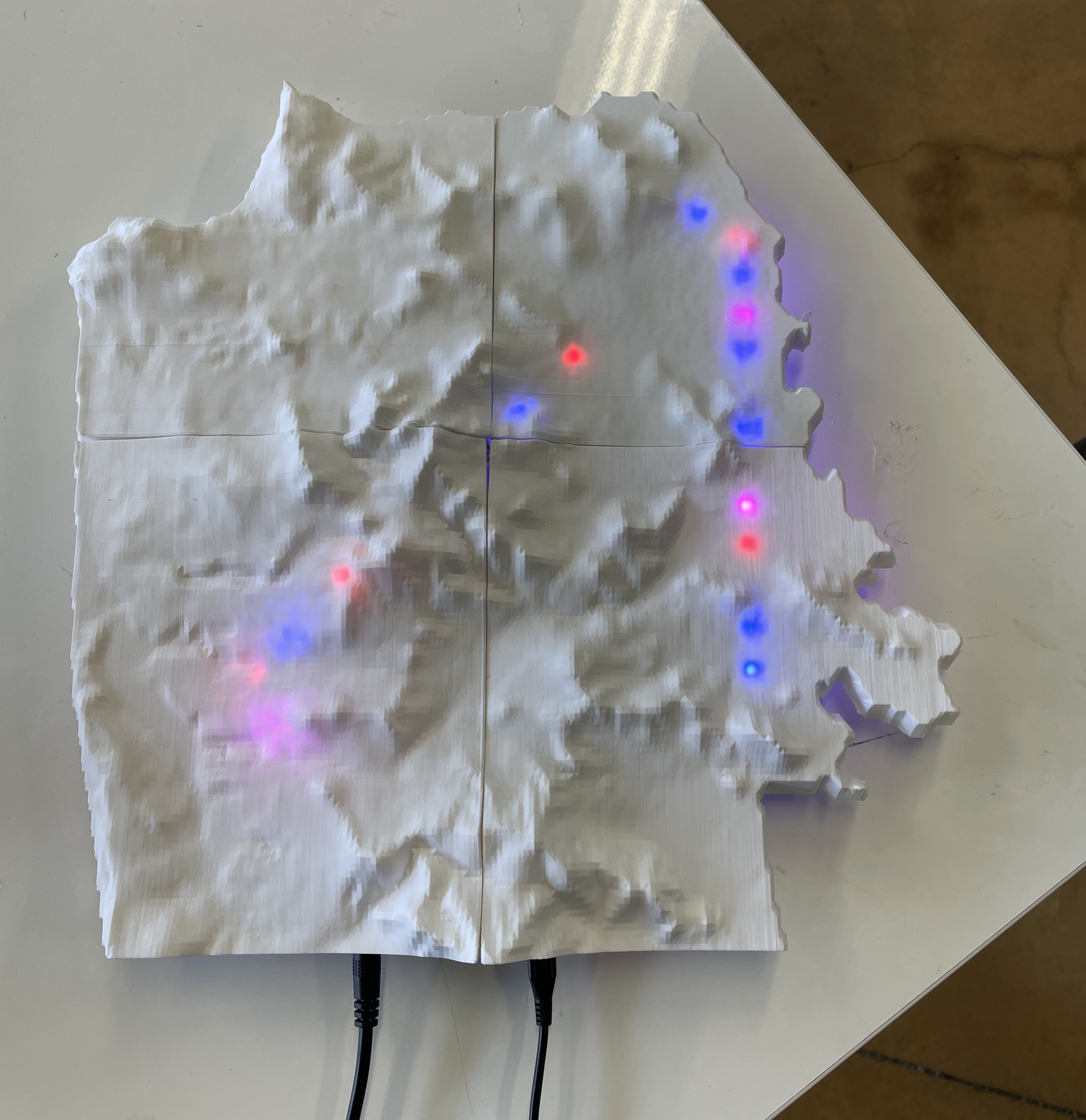
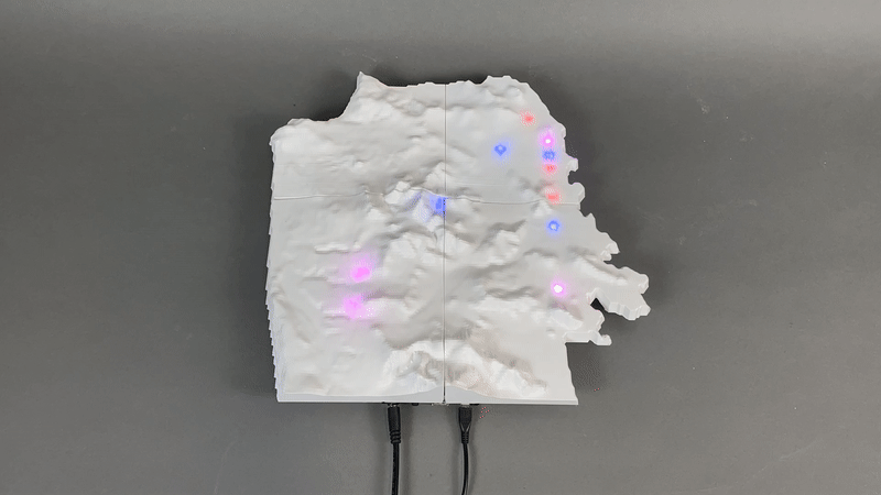
Topographic SF map displaying live positions of the K-line Muni train.
It's one thing to see busses and trains out on the street, or bus lines on a map. But another to see every bus or train that's out on the road. It's difficult to grasp the utility and reach of public transit, and this project hopes to show how useful public transit can be.
This project was a collaborative effort. I worked on the electronics and code behind the map, integrating them into parts done by the rest of our team! It's a proof of concept for a larger map, where every single public transit vehicle in SF would be displayed.
This map displays the live positions of the K-line (previously KT-line) train!
Transit in SF
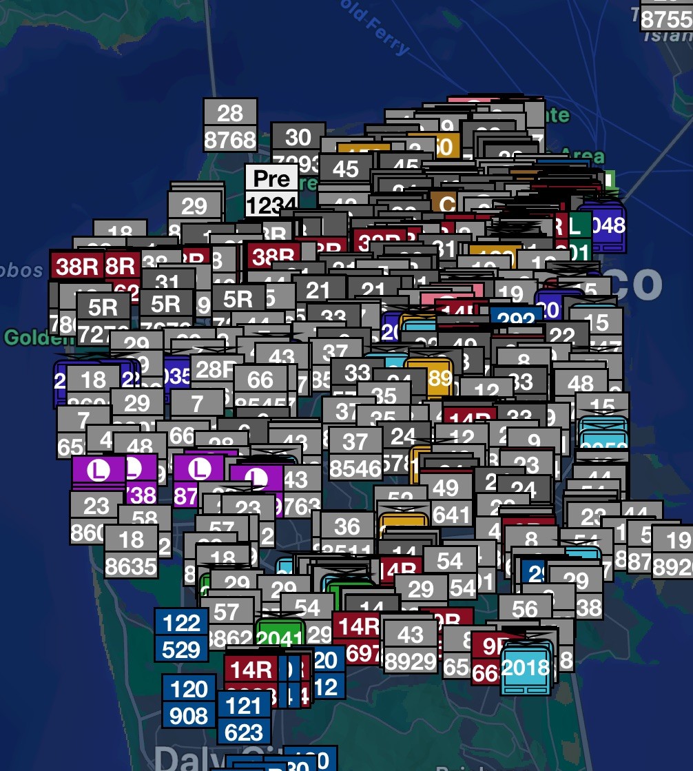
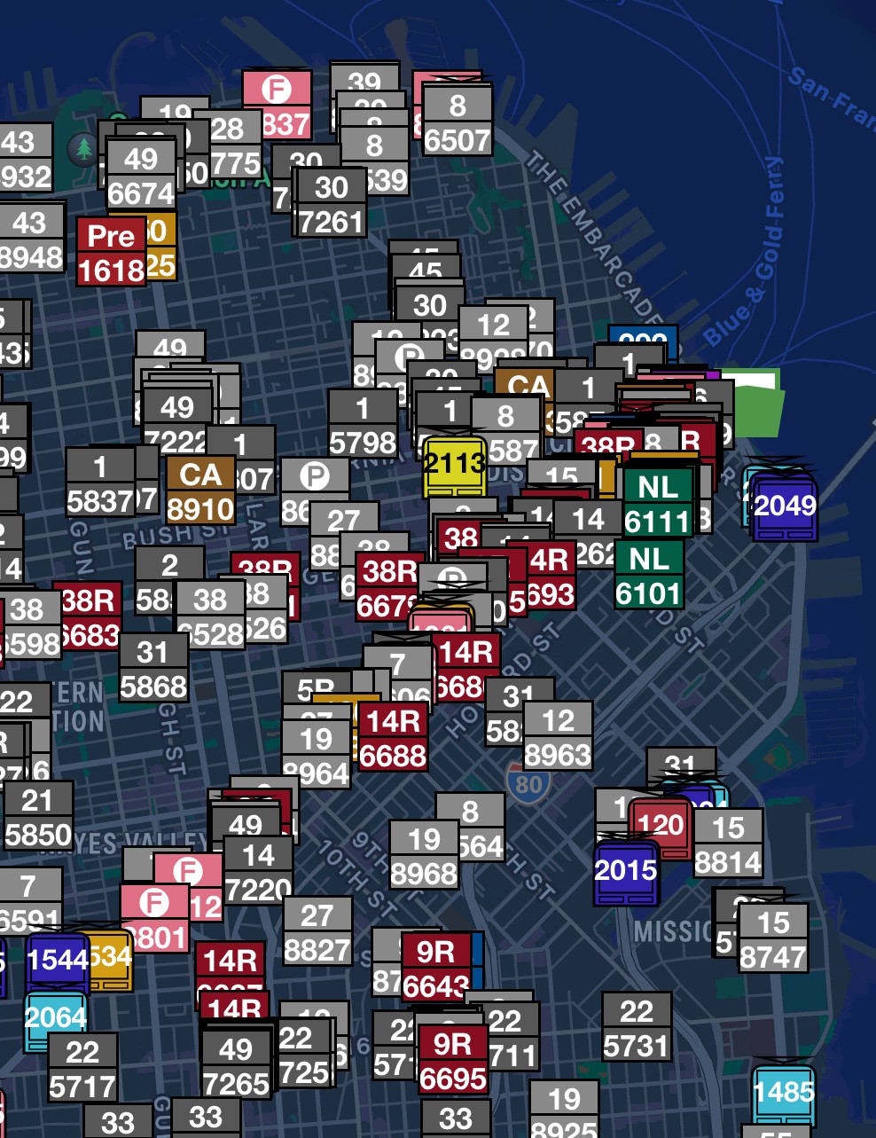
There's often over 1,500 busses on the road in the bay area. Here's some images from the Pantograph app displaying these live positions.
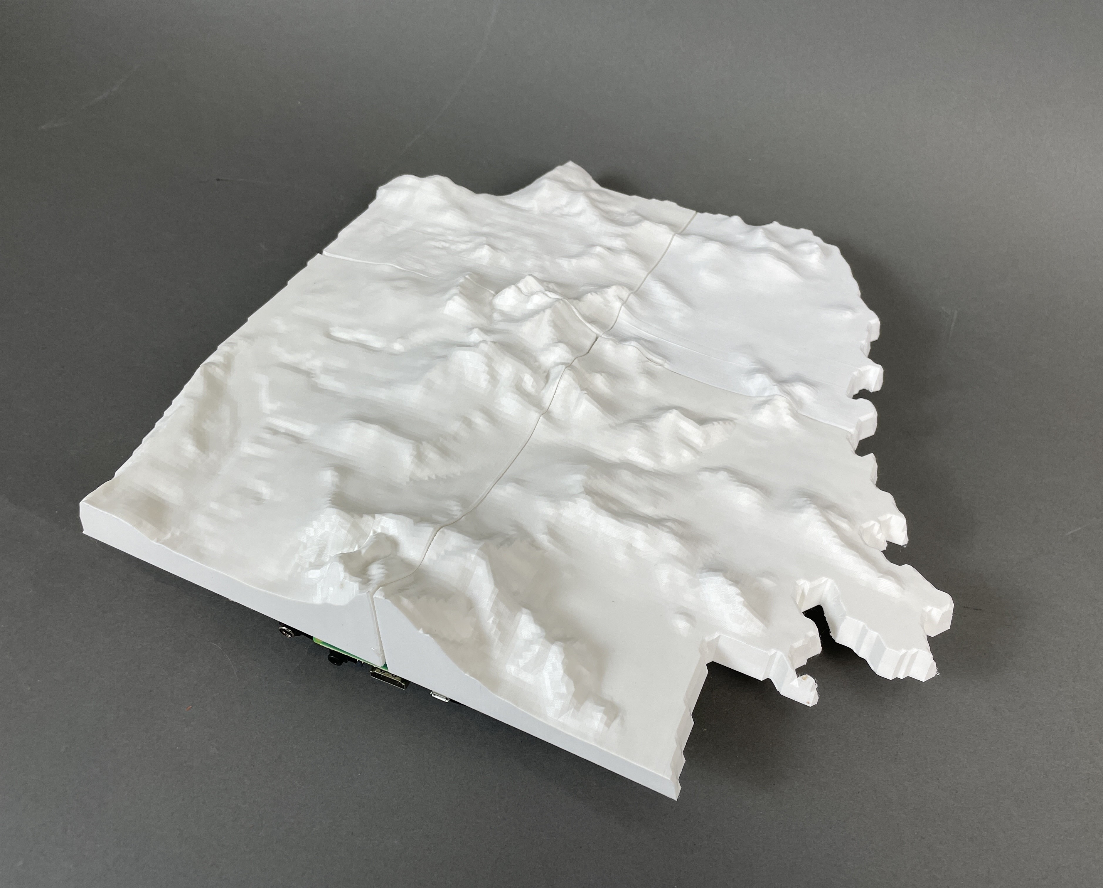
Topographical Map
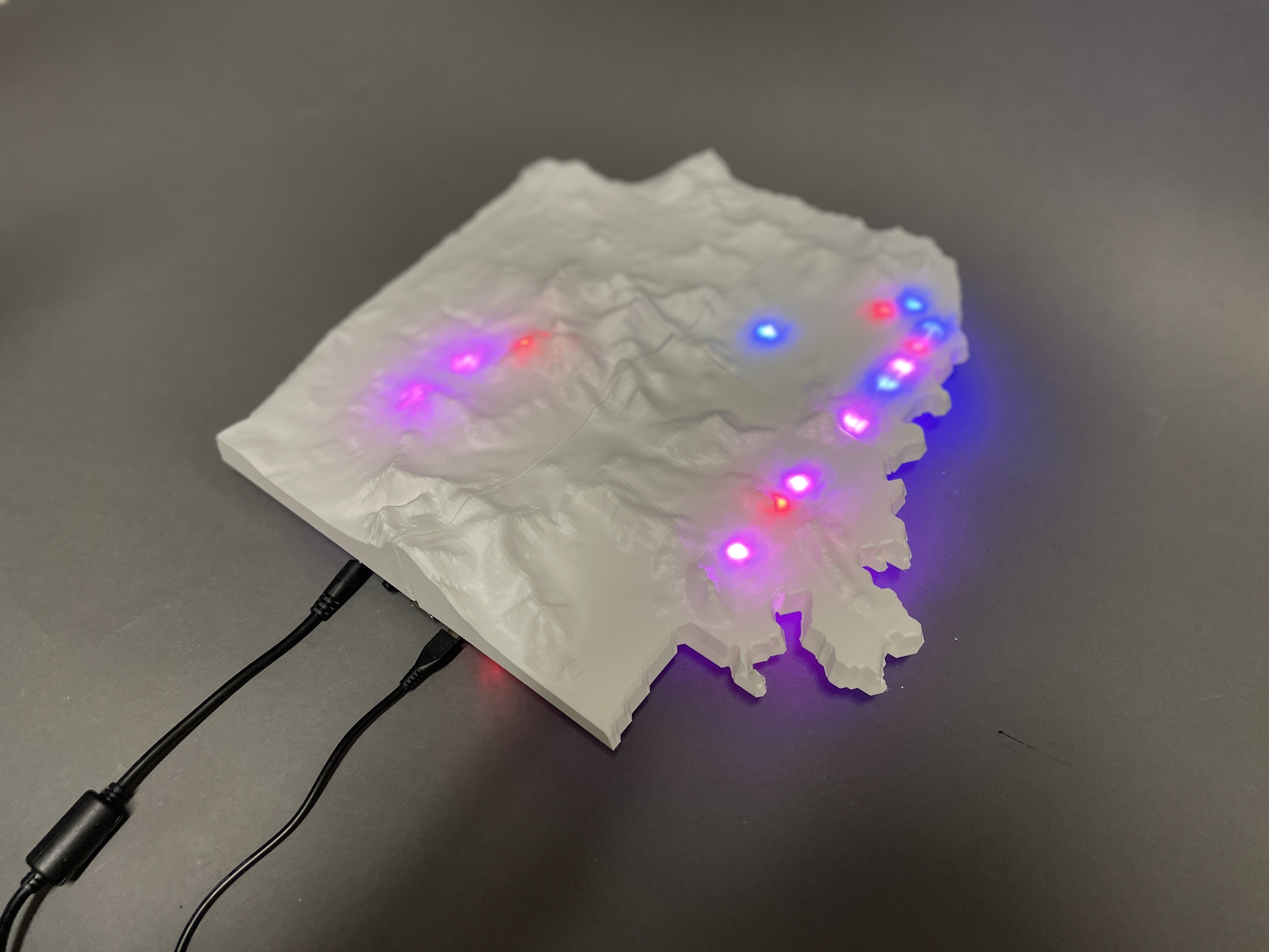
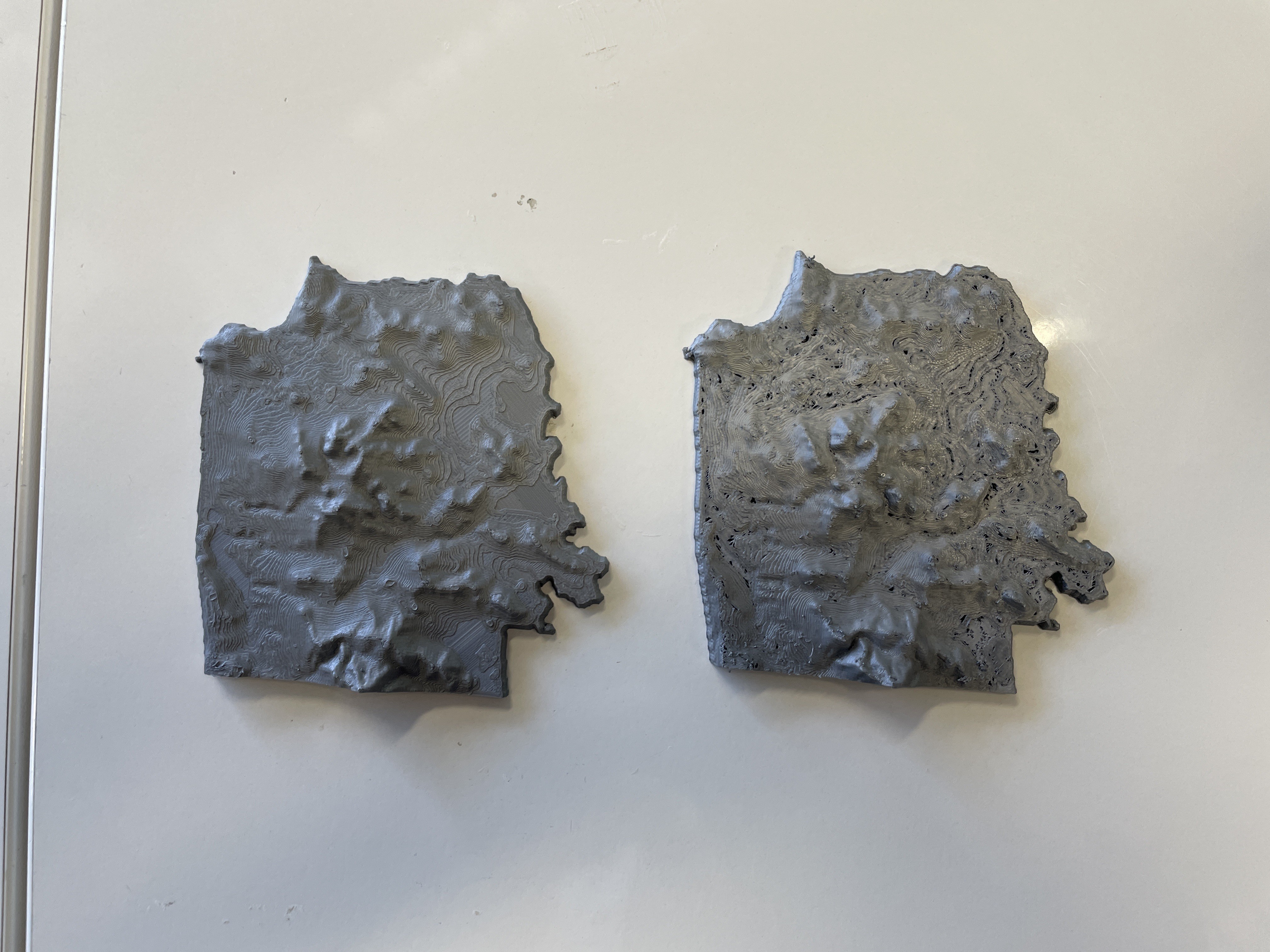
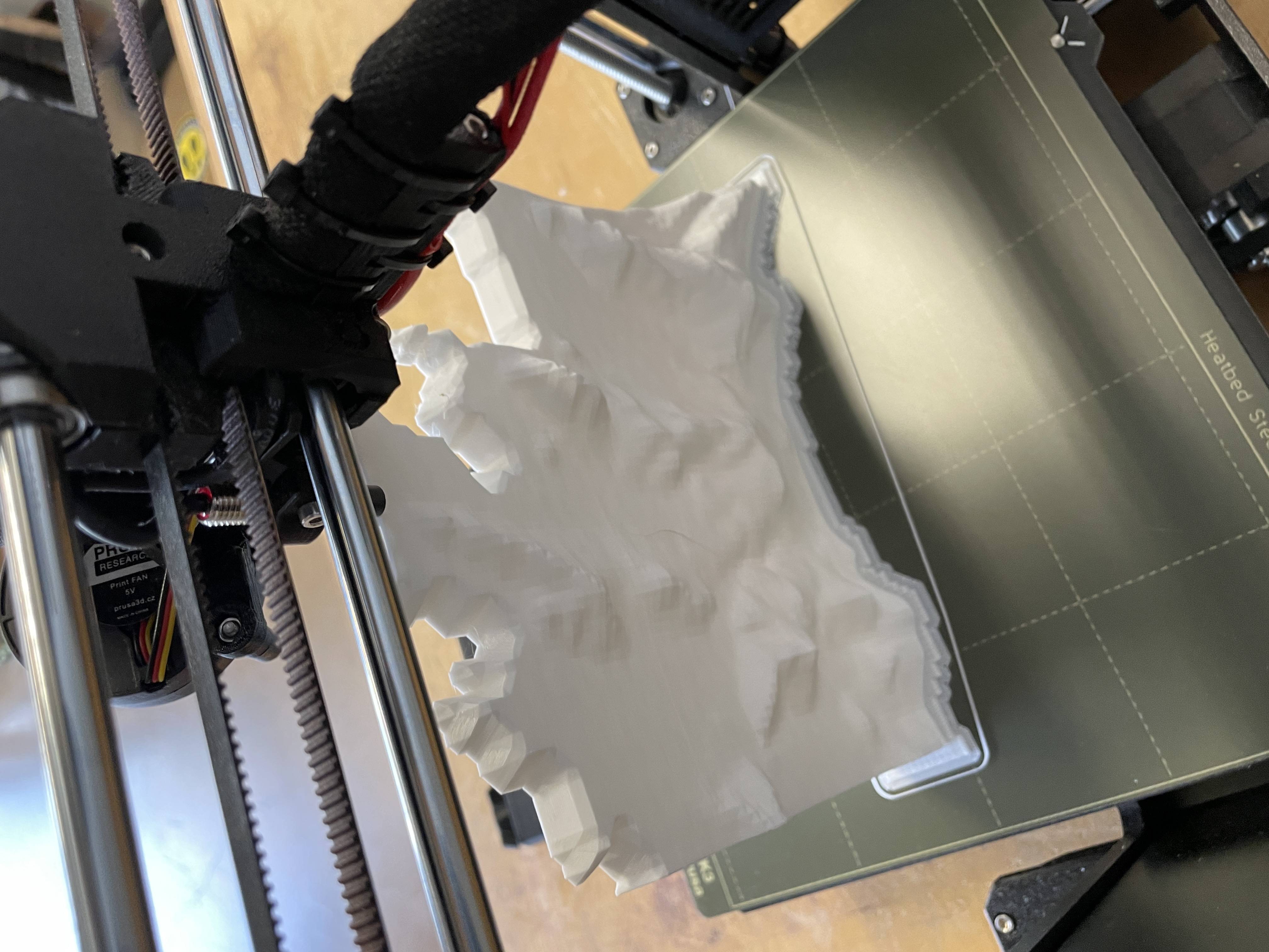
We exported topographic STL files of San Francisco from TouchTerrain, and printed them with Prusa 3D-printers. We had to split the file into four pieces to fit on the printing bed, and then glue them together with hot glue.
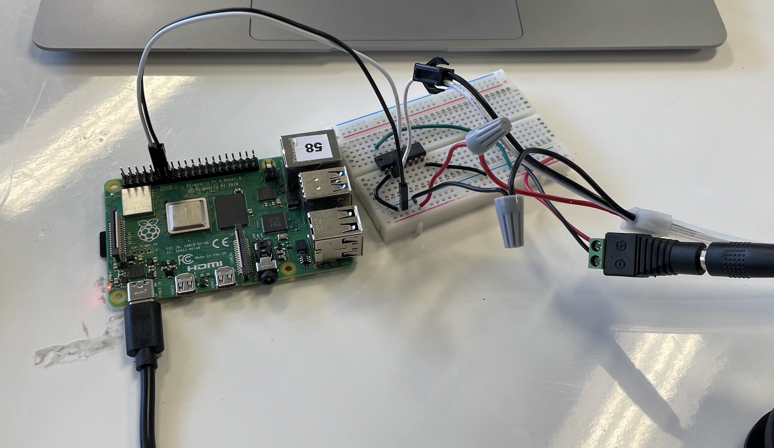
Adding the Lights
We messily dremmled channels for the Neopixel strip into the back of the map, allowing the lights to shine through the plastic. The lights are controlled by a Raspberry Pi, and powered by an external supply.

To map lights on the strip to the transit line, I assigned an estimated latitude and longitude coordinate to each pixel. This was difficult and was definitley not precise, but worked.
Live position data is fetched from the API used to display maps on SFMTA's route pages, which I found on the Network tab of inspect element. It returns latitude and longitude coordinates of each vehicle, which which I found the nearest LED.
Blue lights are inbound, red lights are outbound. Purple lights are where both overlap.